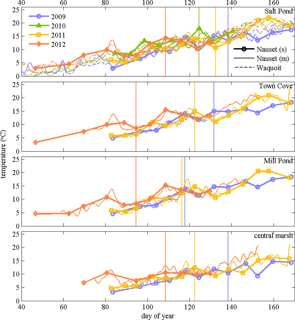
Figure 7.
Near-surface water temperature from stations in Salt Pond, Town Cove, Mill Pond, and the central marsh (Hemenway) from weekly surveys in 2009 through 2012 (s); only Salt Pond had observations in 2010. Also shown are continuous time series from moored temperature sensors near each location (m). In the top panel, dashed lines are moored temperature time series from Waquoit Bay in the same years. Vertical lines denote when maximum cell concentrations were observed at each location.

