Fig. 1.
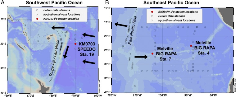
Map of study locations. (A) The southwest Pacific, where KM0703 SPEEDO Station 19 (20°S, 170°W) is indicated in red and the hydrothermally active Tonga–Kermadec Arc is indicated as a topographic high along 175°W. (B) The southeast Pacific, where Melville BiG RAPA Stations 7 (26.25°S, 104°W) and 4 (23.5°S, 88.75°W) are indicated in red and the hydrothermally active EPR is designated. Shown as squares are stations of historical 3He data that were used to interpolate the average 3He profiles onto this study's sampling locations (historic 3He data from cchdo.ucsd.edu); the more proximal stations had a greater influence on the interpolated 3He profile than the distal stations. Shown as crosses are sites of confirmed or inferred hydrothermal venting deeper than 1,000 m (33). Directions of mean advection at 2,000 m (36) are indicated with black arrows.

