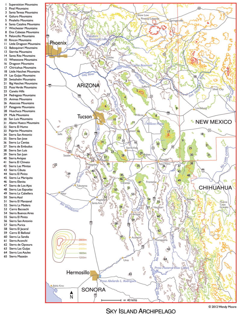
Figure 1.

Elevation map of the Sky Island Region with 65 Sky Island mountains labeled. Green shading indicates approximate area above 1600 m (5250 ft), roughly the elevation at which oak woodlands first begin, although there is considerable variation in this due to latitude, slope and aspect, rainfall patterns, etc. (Map based on cartographic GIS research by Joel Viers/Lirica.)
