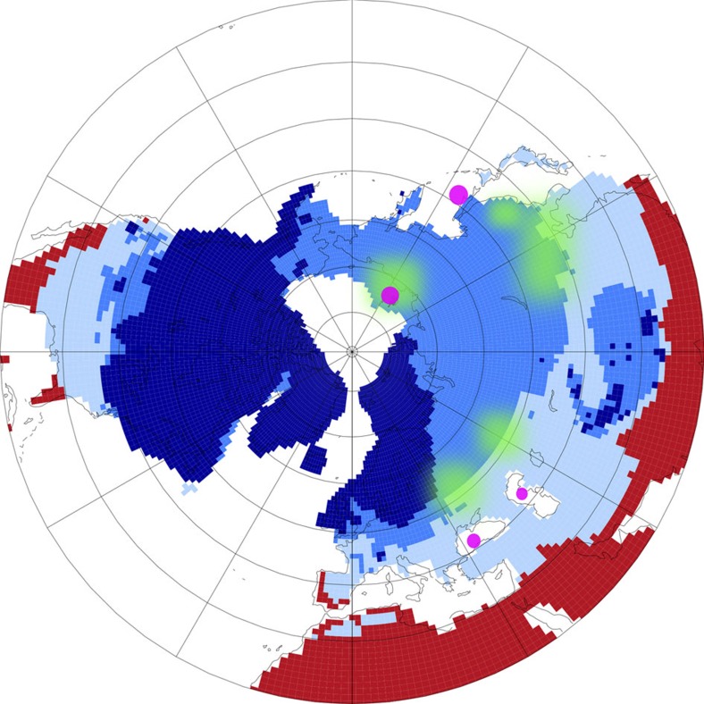
Figure 7. PMIP3 simulation results on the LGM permafrost extend.
Results41 show a polar projection of the NH from 20 °N northwards, are based on soil temperature and distinguish land with ice (dark blue), permafrost (blue), seasonal frozen (light blue) and not frozen (red). Present day coastlines are sketched in thin black lines. Magenta points mark potential core sites (Siberian Shelf, Black Sea, Caspian Sea, Sea of Okhotsk) from which future 14C measurements on terrigenous material might verify the age of permafrost possible thawed around 14.6 kyr BP (suggested green areas).

