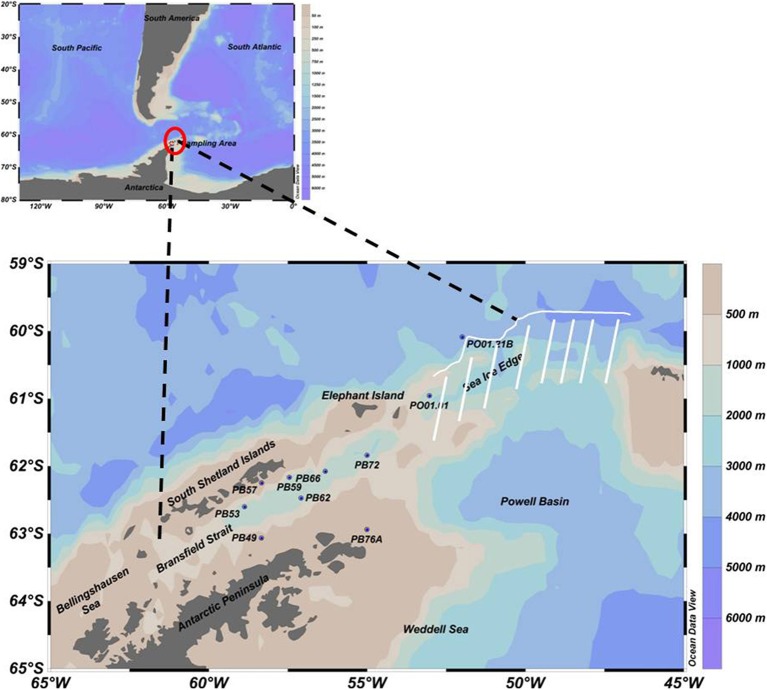
Figure 1.
Sampling map with 10 selected oceanographic stations in the Southern Ocean, from the Bransfield Strait (northwest of the AP) to the open ocean near the sea ice edge (north of the AP), represented by the white line. Due to ice, navigation was impossible in the region indicated by the white stripes.

