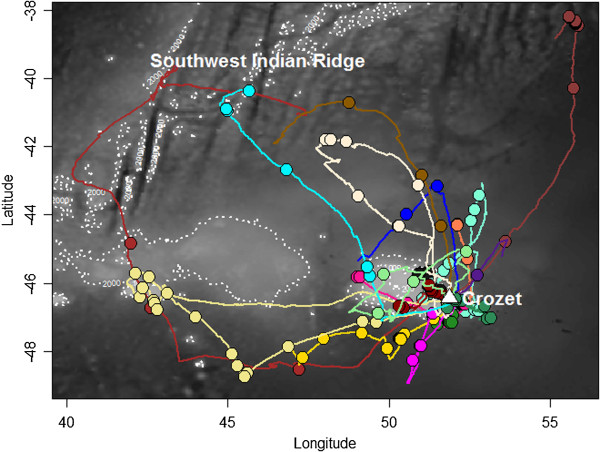
Figure 3.

Map showing all GPS tracks (n = 18) with prey capture information of wandering albatross breeding in Crozet (Southern Indian Ocean), during the brooding of 2002-2005 period. Lines and points represent continuous trajectories and prey captures, respectively. Each colour represents one individual. The white triangle indicates the breeding colony. Background grey scale corresponds to the bathymetry and isobaths of 200, 1000 and 2000 m are also highlighted (white dotted lines).
