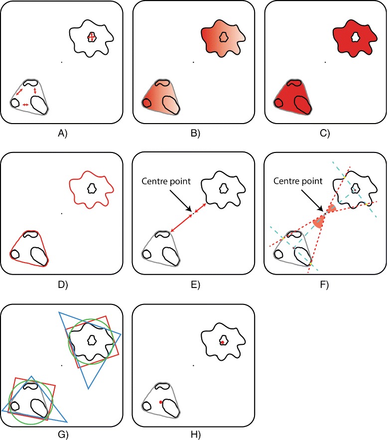
Figure 5.

Visual description of the spatial measures. The clusteredness (A) computes how close regions/neighbouring positions are to each other in a cluster/region. Density (B) measures the average value (e.g. concentration) of the considered positions in the discretised space. Area (C) and perimeter (D) have the usual meaning from discrete 2D geometry. Distance from the origin (E) represents the minimum distance between the point from the centre of the discretised space and the considered region/cluster. The angle (F) associated to a region/cluster is determined by three points: the origin, and the points found at the intersections of the region/cluster convex hull with the line perpendicular on the line determined by the origin and the centroid of the region/cluster. The shape (G) is determined by computing the degree of similarity between the shape of the region/cluster and a triangle, rectangle and circle. The centroid (H) is the geometric centre of the considered region/cluster.
