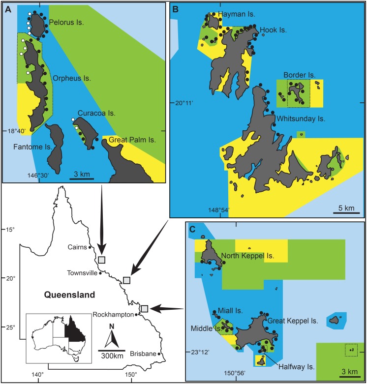
Figure 1. Study location map, showing the post-2004 management zoning for the Palm (A), Whitsunday (B) and Keppel (C) Island groups.
Green shaded areas are no-take marine reserves (Marine National Park zones) that prohibit all fishing (NTMRs); Yellow shaded areas (Conservation Park zones) permit restricted recreational fishing; Dark blue shaded areas (Habitat Protection zones) are open to all forms of fishing except demersal trawling; Light blue shaded areas (General Use zones) are open to all forms of fishing. NTMRs that were established in 1987 are bordered by dashed lines, all other NTMRs were established in 2004. Circular markers indicate the approximate location of all (94) monitoring sites. The 10 sites in the Palm Island group at which derelict fishing lines were removed and line re-accumulation was quantified are labeled with white markers and site name codes.

