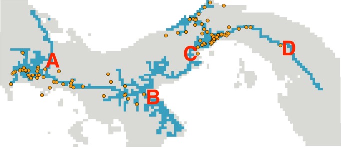
Figure 2. Geographic model predicting future range expansion of Ae. albopictus in Panama.
This model is based on the best-performing-species distribution model (highway network model). Blue pixels represent locations predicted to be likely areas of Ae. albopictus expansion, whereas gray pixels represent areas that had a model suitability that was below the minimum threshold and therefore were unlikely to harbor mosquitoes. Orange points represent species occurrences sampled between 2010 and 2013. A series of surveillance and fumigation chokepoints at strategic locations on the highway network (e.g., points A, B, C, and D) could limit the continued expansion of Ae. albopictus as a first step to reduce the epidemiological risk posed by this invasive vector.

