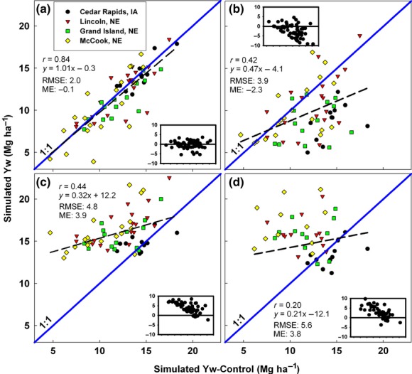
Fig 2.

Simulated maize Yw across four sites in the USA Corn Belt using weather data from NOAA-SR (a), NCEP (b), Climate Research Unit (c), and NASA (d) plotted against simulated Yw based on a control weather database. Insets show deviations of points from the 1:1 line for each site and year for which yield was simulated with GWD or NOAA data. RMSE and mean error units are in Mg ha−1. Symbols represent different locations. NASA Yw simulations were performed for the time interval 1997–2007. Average water deficit (mm) over the maize growing season, as determined by simulations using control-data, was −42 (Cedar Rapids, IA), −135 (Lincoln, NE), −149 (Grand Island, NE), and −238 (McCook, NE).
