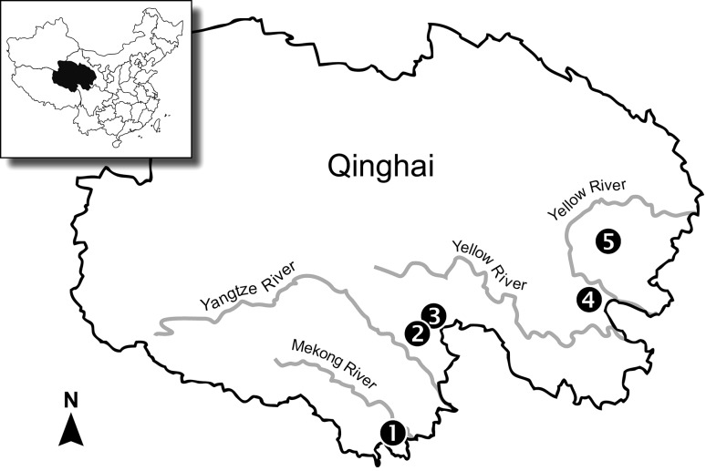
Fig. 2.
Map of the study area on the Qinghai-Tibetan Plateau, People’s Republic of China. Locations for measurements were broadly spread across the alpine meadows of eastern Qinghai Province (average elevation = 4000 m), and encompassed the drainage systems of the Mekong (Nangqian = map site 1), Yangtze (Chendou = 2, Zhenqin = 3), and Huang He (Dawu = 4; Sendou = 5) rivers

