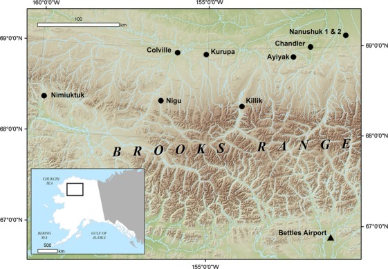
Figure 1.

Location of the nine landscapes used in this study across the Brooks Range and North Slope uplands (indicated with a black circle) and the location of Bettles Airport weather station which served as the source of climate data in this study (indicated with a black triangle).
