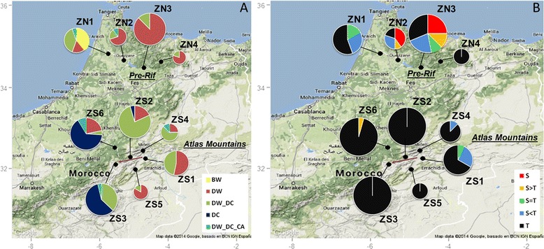
Figure 1.

Maps of the study areas showing the morphological composition of the sampling zones. A. Frequencies of the different spike-type classes of populations. Each colour represents a spike-type class. BW: populations containing bread wheat. DW (resp. DC): pure populations made of DW (resp. DC) spike types. DW_DC: mixed populations combining DW and DC spike types. DW_DC_CA: mixed populations including DW, DC and CA spike types. B. Frequencies of the different stature classes of populations. Each colour represents a stature-class. S. (resp T.): pure populations made of short (resp. tall) statures. S > T, S = T, S < T: mixed populations containing respectively more than 66%, between 33 and 66%, and less than 33% of short statures. Chart pie diameters are proportional to the number of populations sampled in each zone. The arrow in the Atlas Mountains underlines the position of the Ziz valley, from low (ZS1) to high elevation (ZS3) (see text). The map backgrounds have been extracted from Google Maps.
