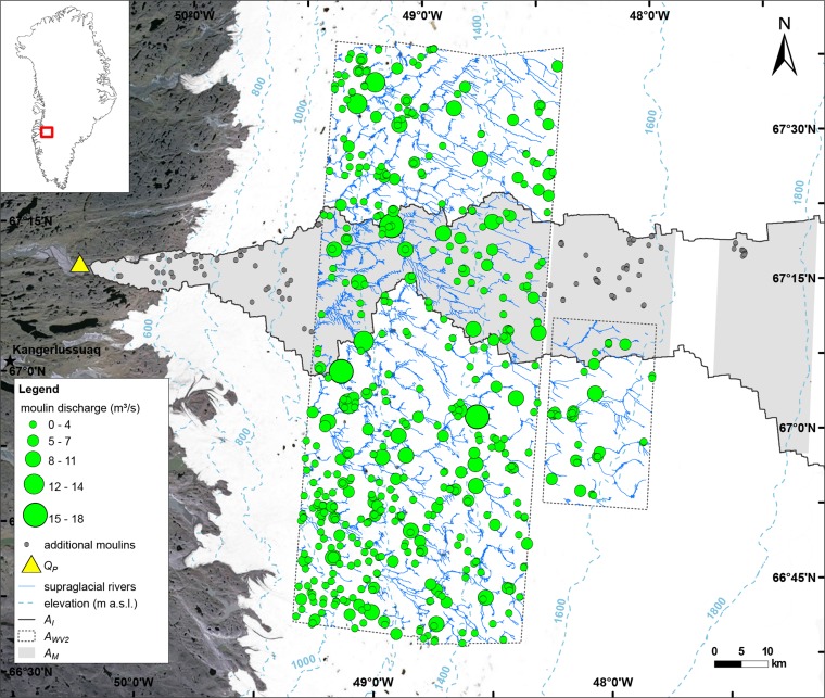
Fig. 2.
Five hundred twenty-three supraglacial river networks, their terminal moulin locations, and moulin discharges were mapped from 32 multispectral WV2 images, with calibration from contemporaneous field measurements collected on the ice sheet (18–23 July 2012). An additional 102 moulins were mapped from panchromatic WV1 imagery (black circles). Downstream discharges from the proglacial river Isortoq were also observed (yellow triangle). All mapped supraglacial rivers terminated in moulins (green circles, with diameters proportional to estimated meltwater flux), with negligible water impoundment in depressions and supraglacial lakes on the ice sheet surface.

