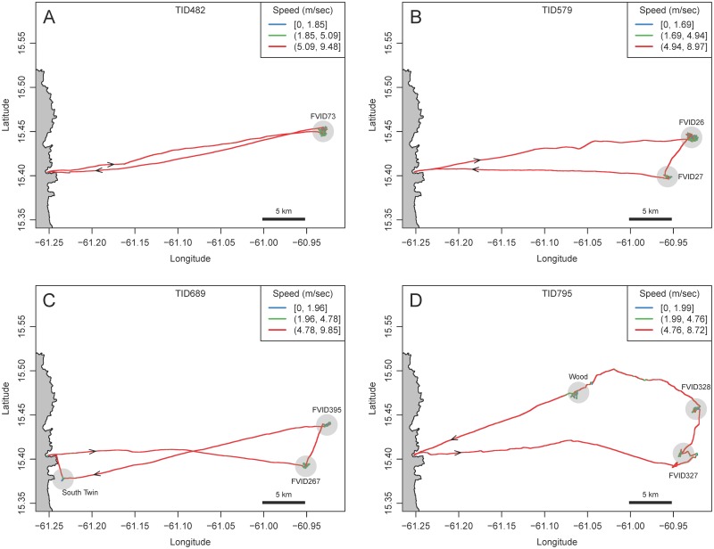
Fig 2. Four example GPS tracks of foraging Dominican FAD fishers.
The east coast of Dominica is indicated on the left of each plot. Trips originate at Desa Ikan and travel eastward toward the FADs. Track points are colored to indicate speed. (A) Trip to one FAD. (B) Trip to two FADs (C) Trip to a FAD and a near shore shallow water FAD. (D) Trip to two FADs and a wood. Each track is identified by a Trip ID number (TID). Arrows indicate direction of travel. Transparent blue circles indicate areas that were identified as patches by the observer and subsequently identified as ARS. See Fig. 5 for a higher resolution plot of tracks at patches.

