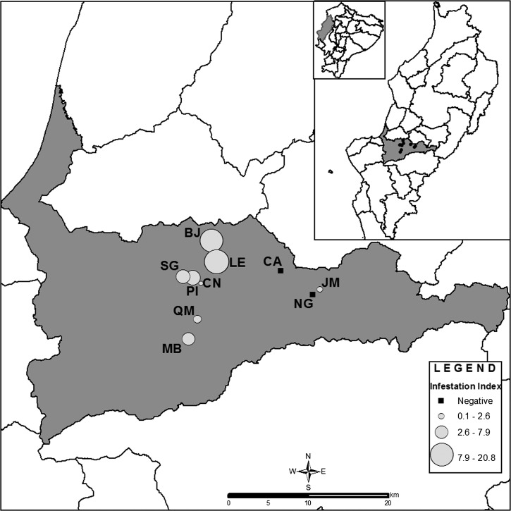
Figure 1.
Map of Portoviejo County, Manabí Province indicating the location and P. howardi infestation rates of 10 rural communities studied on the central coast of Ecuador. Lines indicate county boundaries. Inset shows Ecuador's political division and study area. BJ, Bejuco; CA, Cruz Alta de Miguelillo; CN, La Ciénega; JM, Jesús María; LE, La Encantada; MB, Maconta Abajo; NG, San Gregorio; PI, Pimpiguasí; QM, Quebrada de Maconta; SG, San Gabriel.

