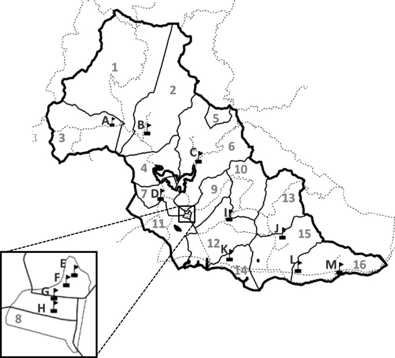
Figure 1.
Map of the participating schools and neighborhoods of Patillas, Puerto Rico in 2007 and 2008. Black boxes with flags represent participating schools. The heavy black solid line represents the borders of the municipality of Patillas. The light solid black lines represent the border for each Patillas neighborhood. The dotted black lines represent major roads. The letters represent the school designation, and the numbers represent neighborhood designations. Neighborhood 8 (Inset) is the urban center of Patillas, where four of the participating public schools (E–H) are located.

