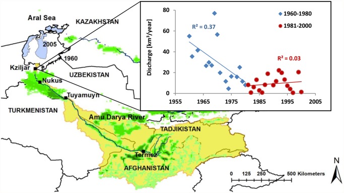
Fig 1. The Amu Darya drainage basin (outlined in yellow) with the Amu Darya River and gauging station Kziljar located in the Amu Darya River delta south of the sea, and the upstream gauging stations Nukus, Tuyamuyn reservoir complex and Termez.
The extent of the Aral Sea in 1960 (white) and in 2005 (filled blue), irrigated areas (green), and temporal trend in annual mean discharge at Kziljar station for the periods 1960–1980 (blue), and 1981–2000 (red) are shown.

