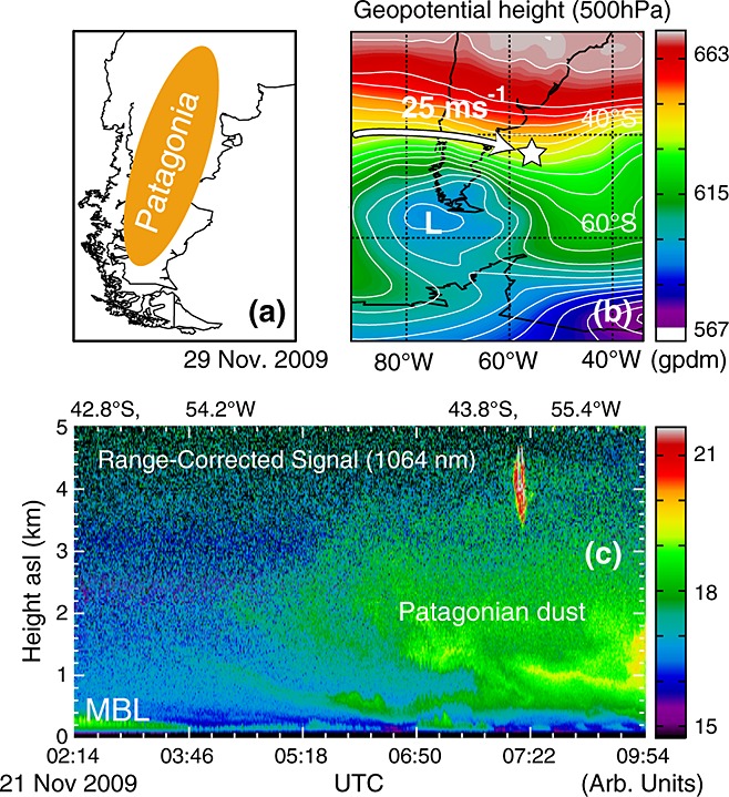
Figure 6.

Map of (a) South America and location of Patagonia, (b) geopotential height (gpdm) at 500hPa and position of Polarstern (white star) on 21November 2009. White arrow indicates the air mass advection along the isohypses (height contours) with surface wind speeds of 25ms − 1. (c) Lidar observation, performed on 21November 2009, of the arrival of a Patagonian dust plume with AOT around 0.03.
