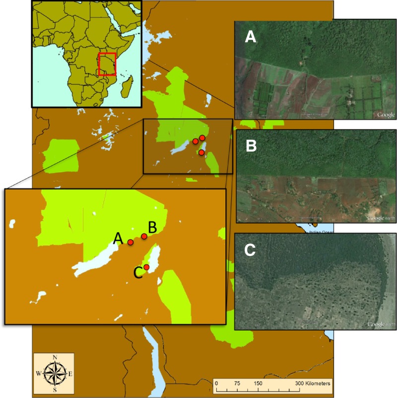
Figure 1.
A map of the three site pairs in northern Tanzania at different scales, with nationally conserved areas designated in green. Insets of satellite images (from Google Earth) show that stark differences in land use occur directly outside the boundaries of these protected areas. These borders separate conserved and agricultural treatments used in this study at each of the three field sites: Kambi ya Nyoka (A), Tloma (B), and Manyara (C).

