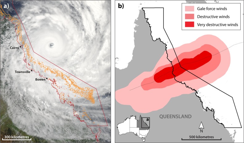
Fig 1. Spatial extent of TC Yasi with wind zone boundaries.
(a) Satellite-based photograph of TC Yasi on February 2, 2011 prior to crossing the Queensland coast between Townsville and Cairns on February 3 (images courtesy of the Australian Bureau of Meteorology (BoM)). (b) Boundaries of gale force, destructive and very destructive winds from BoM; the extent of gale force winds north to south along the GBR exceeded 600 km.

