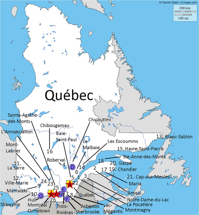
Fig 1. Location of RST EDs, Level 1 and 2 trauma centers, and airbases in Quebec.
The Québec map was originally taken from http://d-maps.com/. All the maps are protected by copyright. They are free for any use, even commercial, in the following conditions:
-The exact URL where the original map comes from must be mentioned
-The number of used maps is limited to 10 for a publication (Web, DVD, book…)
-The number of used maps is unlimited with BeGraphic GIS use.
The cities where the 26 RST EDs are located are identified on the map. The red stars (A, B, C) represent the Level 1 trauma centers (refer to [18] for definition of trauma centers). The blue circles (D, E, F, G, H) represent the Level 2 trauma centers (refer to [18] for definition of trauma centers). The yellow square (A, B) represent the location of the airbases. Trauma centers: A = Hôpital de l'Enfant-Jésus (CHU de Québec); B = Hôpital du Sacré-Cœur de Montréal; C = Montreal General Hospital; D = Hôpital de Chicoutimi; E = Centre Hospitalier Régional de Trois Rivière; F = Hôpital Fleurimont (CHU de Sherbrooke); G = Hôpital de Hull; H = Hôpital Charles-Lemoyne.

