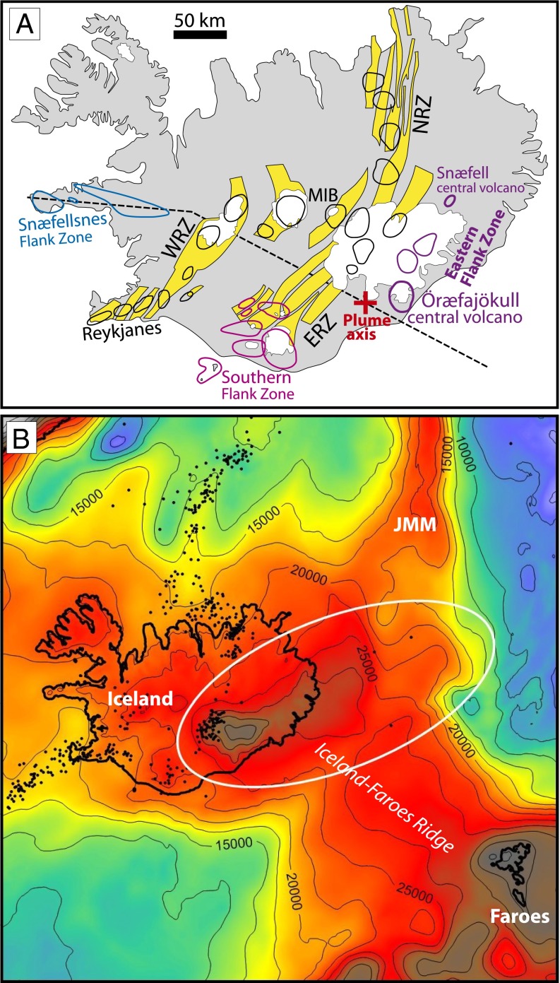
Fig. 2.
(A) Simplified geological map of Iceland outlining the major rift zones (RZ), rift zone central volcanoes (black outline), flank zone central volcanoes (colored outlines), the location of the Öræfajökull central volcano, and the position of the current plume axis of Shorttle et al. (25). Yellow areas are fissure swarms. WRZ, ERZ, NRZ, and MIB: Western, Eastern, and Northern Rift Zone and Mid-Iceland Belt, respectively. The stippled west-northwest–trending line through the plume axis depicts the position of the cross sections in Fig. 9. (B) Enlarged crustal thickness map (Fig. 1) with superimposed earthquake locations (earthquake.usgs.gov/earthquakes) and contour intervals (in meters) showing that the anomalously thick crust under southeast Iceland extends offshore to the northeast suggesting that it is a southerly fragment of the Jan Mayen Microcontinent (JMM) rather than an extension of the southeast-northwest–orientated Iceland-Faroes Ridge.

