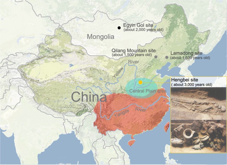
Fig 1. Geographic location of the Hengbei (HB) and Central Plain regions.
HB is marked by a yellow circle, and the Central Plain region is indicated by a cyan ellipse. XN population is marked by a black circle, and XB populations are marked by two grey circles. The red area marked on the map represents the location of the southern Han, and the green area marked in China represents the location of the northern Han. The human remains and sacrificial vessels in the two photos in the lower right corner were both excavated from the Hengbei site.

