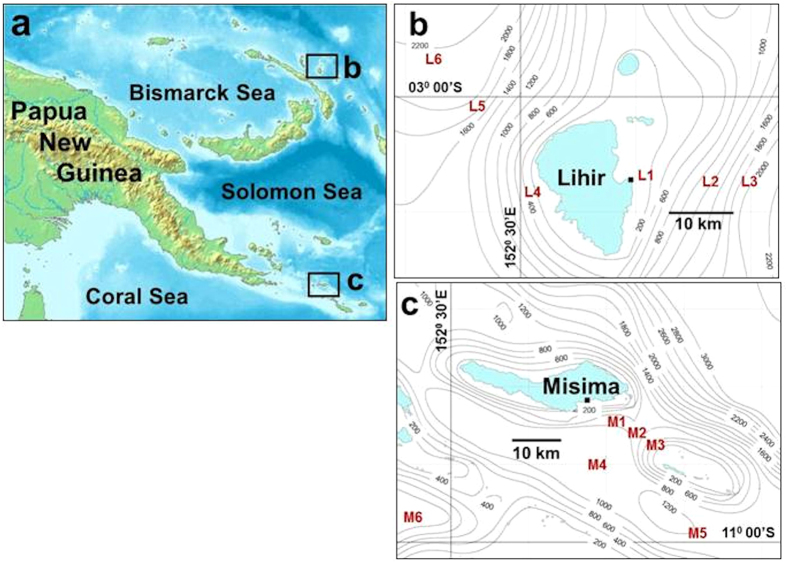
Figure 1. Study areas, Papua New Guinea.
(a) Locations of Lihir and Misima islands. Map modified from original on Wikimedia Commons, source www.demis.nl. (b) Benthic sampling stations off Lihir (L1-L6) and (c) Misima (M1-M6). Tailings outfalls are indicated by solid squares on island coastlines. Detailed bathymetric charts are not available for the Lihir and Misima areas, and (b) and (c) show only general trends using data from the General Bathymetric Chart of the Oceans (GEBCO, www.gebco.net).

