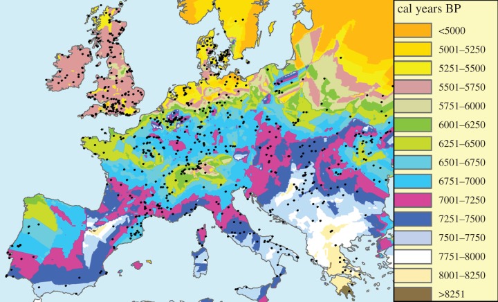
Figure 1.
Isochrone map. The spread of the Neolithic transition, obtained by interpolating the dates in calibrated years before present (BP) of 918 Early Neolithic sites (circles) in Europe and the Near East (see the electronic supplementary material for details on the dataset and interpolation). Map created with ArcGIS 10.

