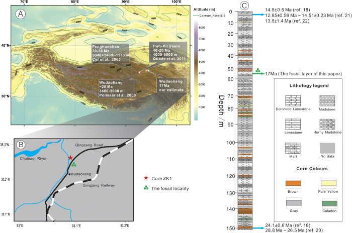
Figure 1. Map showing the fossil locality (A, B) and the stratigraphical section of the Wudaoliang Group (C).
A showing the Tibetan Plateau and quantitative estimations of palaeoaltimetry for northern Tibet. B showing the locations of our fossil (35°13’56.90“N, 93° 05'10.50“E, 4611 ± 9 m) and core ZK1 (35°14’18.40“N, 93° 05'22.80“E, 4666 m). C showing the stratigraphical section of core ZK118, including the ages at top and bottom of the Wudaoliang Group, which are in accordance with previous data from dating of the Wudaoliang volcanics20,21,22. The maps are created by authors using “ArcGIS 10” and “CorelDraw 14” software. The stratigraphical section is drawn by authors using “CorelDraw 14” software based on the data from refs. 18, 20, 21, 22.

