Figure 1.

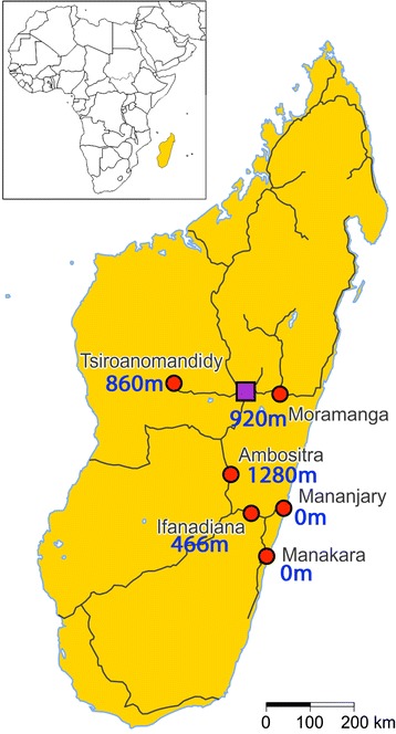
Map of Madagascar showing the six study locations with their altitude. The red circles indicate the six study locations and the purple square the capital Antananarivo. The black lines represent the main roads for long distance travel.

Map of Madagascar showing the six study locations with their altitude. The red circles indicate the six study locations and the purple square the capital Antananarivo. The black lines represent the main roads for long distance travel.