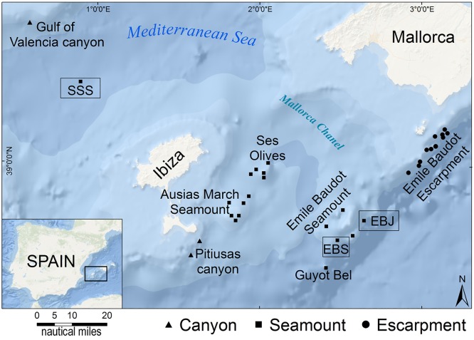
Fig 1. Study site location.
The inset shows the location of the Western Mediterranean surveyed area. The large map indicates the location of the 32 ROV transects. The framed squares (Stone Sponge Seamount = SSS; Emile Baudot Jr. Seamount = EBJ; Emile Baudot South Seamount = EBS) indicate the 3 seamounts reported in this study where the lithistid sponges grew abundantly.

