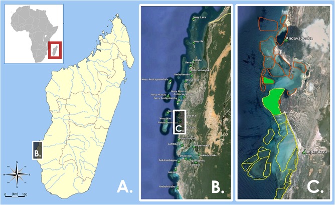
Fig 1. Maps of Study Area.

(A) Large-scale map of Madagascar and the African continent, (B) Inset of the 25 villages of the Velondriake Locally Managed Marine Area in southwestern Madagascar. Vertical box extent is ~75 km. (C) Representative example of a periodic octopus fishery closure. Indicated in the map are two villages, Andavadoaka and Ampasilava, with their respective octopus fishing sites mapped in orange and yellow. In green, you can see the sites Amagnahitse and Nosinkara, in which these two villages have repeatedly co-implemented a periodic octopus fishery closure.
