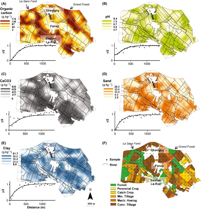
Figure 1.
Maps and variogram soil and land use characteristics observed at the scale of the Fénay Landscape. Map of (A) soil organic carbon content, (B) soil pH, (C) CaCO3, (D) sand content, (E) clay content, and (F) land management clusters. Points indicate the sampling locations. Min., minimum; mech., mechanical; conv., conventional. For each kriged map the color scale to the left of each map indicates the extrapolated values expressed as g.kg−1 of sample excepted for pH. Points represent the experimental variogram, continuous lines the Matérn models fitted by maximum likelihood method. Geostatistics and cross-validation parameters are provided in Table S2.

