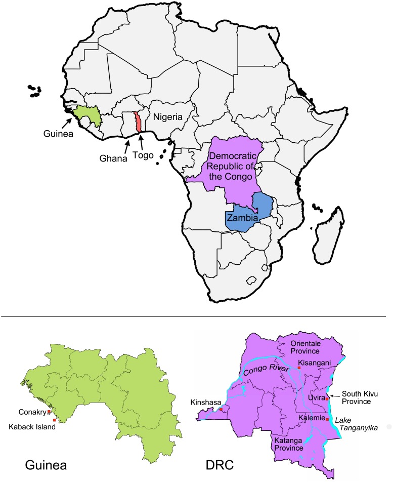
Fig 1. Map of African countries implicated in study.
Upper panel: the four countries from which V. cholerae isolates were collected are indicated in different colors on the map of Africa (i.e., Guinea, green; Togo, red; Democratic Republic of the Congo (DRC), violet and Zambia: blue). Ghana and Nigeria are also labeled. Lower panel: detailed maps of Guinea and the DRC are shown. Lower right: DRC; the cities (red squares) and provinces mentioned are indicated on the map. The Congo River and Lake Tanganyika are also shown (in blue). Lower left: Guinea; the capital, Conakry, and Kaback Island are indicated along the Atlantic coast.

