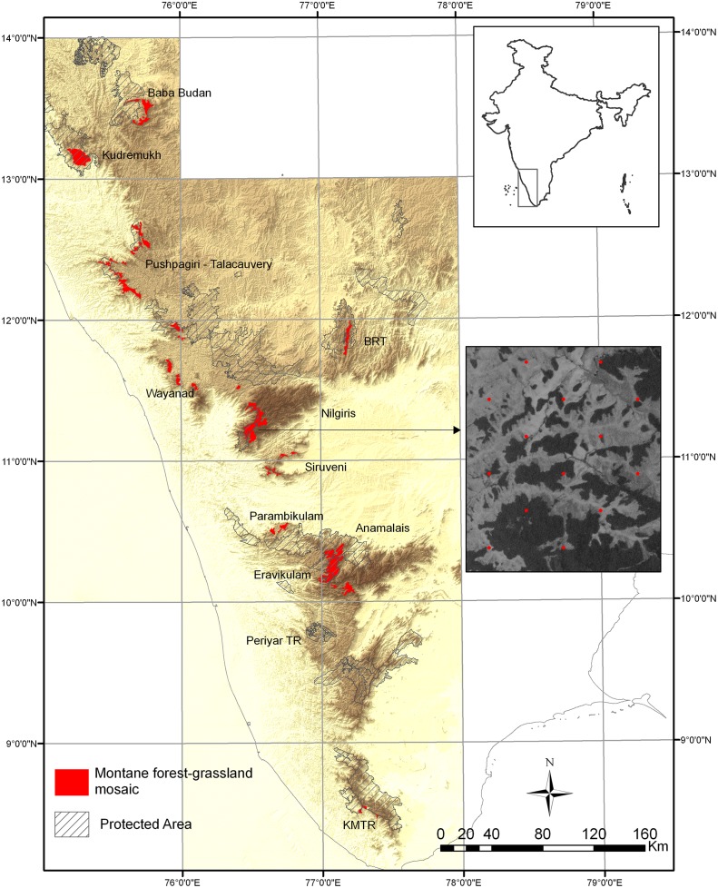
Fig 1. Map of study area.
Map of the Western Ghats showing locations of montane forest-grassland mosaics and inset showing a section of an Indian Remote Sensing Satellite (P6) image of one of the study mosaics with sample points (superimposed in red) spaced 500m apart. Map created using ArcGIS (ESRI) software.

