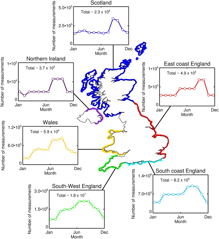
Fig 6. Estimates of the number of measurements on environmental indicators that could be acquired by surfers in the UK per month.
These statistics were computed as follows. Firstly, the total number of surfs per month were computed for a series of regions around the UK by multiplying Table 1 of Mills and Cummins [49] (the number of surfers per region) with Table 20 of Mills and Cummins [49] (the number of times per month by region that surfers go surfing). The regions defined in Mills and Cummins [49] were then aggregated into six key areas: South-West England = Cornwall + South Devon + North Devon; South coast England = South Coast 1 + South Coast 2 + South Coast 3; East coast England = East Coast + North East; Scotland = East Coast Scotland + Morray Firth + North Coast + Outer Hebrides + Orkney Islands + Inner Hebrides; Northern Ireland = Northern Ireland; and Wales = Cardiff + Swansea + West Wales + North Wales. Total measurements for each region per year are also provided. Note that land locked UK surfers defined by Mills and Cummins [49], who are also estimated to surf ∼ 2.6 × 10⁶ per year, were not included in this analysis as it was difficult to determine surfing locations.

