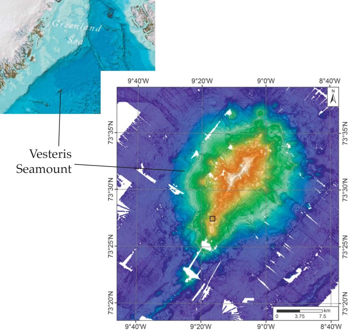
Fig 1. Map of Vesteris seamount.
(A) Map of the northwestern part of the Atlantic showing the location of Vesteris Seamount in the Greenland Basin. Image reproduced from the GEBCO world map 2014, www.gebco.net. (B) Bathymetric map of Vesteris Seamount processed using combined multibeam data from RV Polarstern expeditions ARK II/4, ARK VII/1, ARKXVIII/1, and ARK XIX/4. The location from which the samples examined in this study were taken is marked by a black square.

