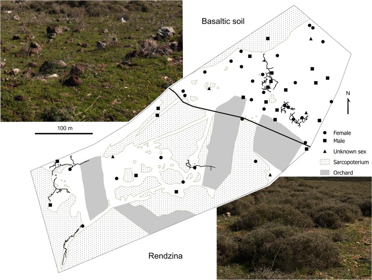
Fig 1. Map of the study microsite with all detected individuals of S. galili.
A bold black line indicates the boundary between the rendzina and basaltic soil parts of the study microsite. Circles and squares represent captured females and males, respectively, and triangles indicate active territories from which animals had not been trapped. Burrow systems excavated are projected on the map. Photographs show typical vegetation types growing in rendzina and basaltic soil at the study microsite.

