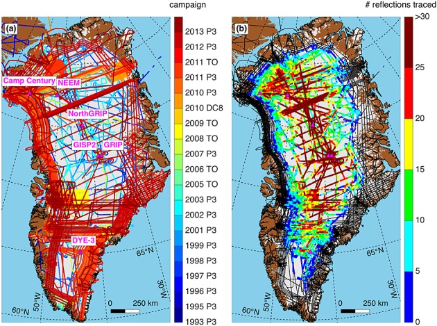
Figure 1.

Airborne ice-penetrating radar surveys collected over the GrIS by KU between 1993 and 2013. Transects are color-coded by (a) campaign and (b) maximum number of reflections traced within 1 km segments along track. Portions of transects shown as black lines indicate no reflections were traced in those segments. Triangle denotes deep ice core sites. Ice, land, and ocean masks are from Bamber et al. [2013].
