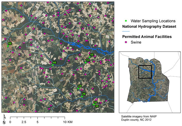
Fig. 1.
Study area showing sampling points within public access waters upstream (A) and downstream (B) of 5 swine CAFO spray fields in Duplin County, NC (USA). Sampling points are overlaid onto the National Agricultural Imagery Program overlay, NAIP 2012 GE. Creeks are indicated by blue lines, and permitted swine animal facilities by pink dots. Distances between the A and B sites were 1.3 km (Site 1), 1.7 km (Site 2), and 0.4 km (Site 3). Sites 4 and 5 were sampled as B locations only. Spray fields 1, 2, and 3 were within 9 km of each other, and all sites were within 20 km of each other. The receiving water bodies were within 10–76 m of the edge of the land application fields. (For interpretation of the references to color in this figure legend, the reader is referred to the web version of this article.)

