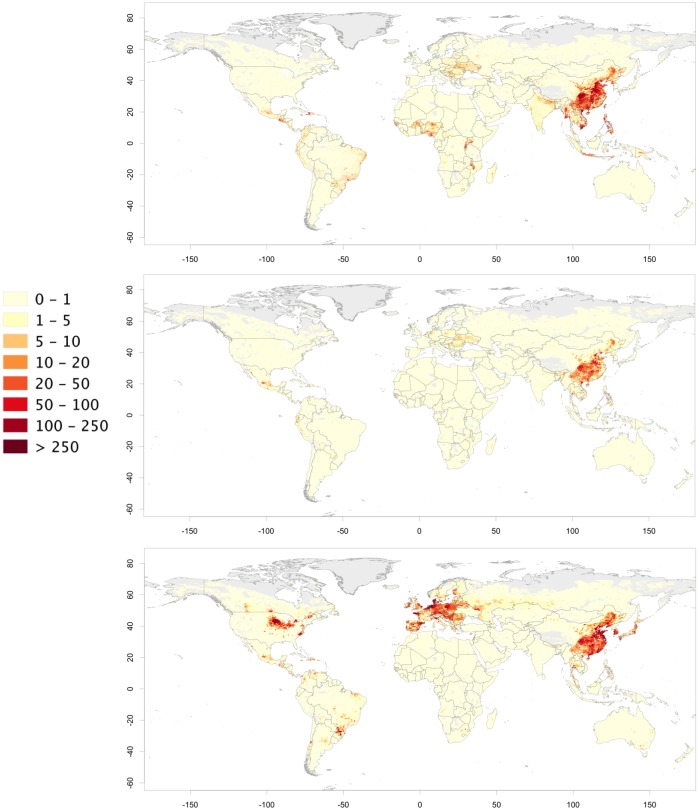
Fig 5. Distribution of pigs (head per square kilometre) raised under extensive (a), semi-intensive (b) and intensive (c) production systems (unprojected lat/long decimal degrees coordinate system, WGS 84).
The data used to produce these maps were all from public sources (detailed in the Material and Method section), and the country limit data are from the FAO Global Administrative Unit Layers (GAUL) database.

