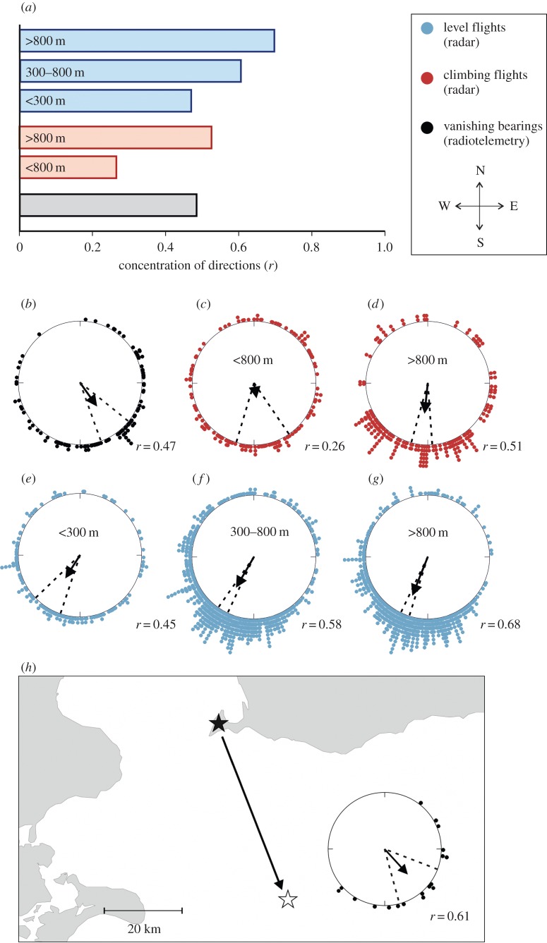
Figure 1.
(a) Mean vector lengths (r-values) of the track directions (radar) of birds in level and climbing flight and vanishing bearings (radiotelemetry) at different altitudes demonstrate a higher concentration of track directions at higher altitudes and in level flight. Circular distributions illustrating the pattern of adjustment of direction once at cruising altitudes: (b) vanishing bearing (mean ± 95% CI = 145 ± 16°), track direction of (c) climbing birds with altitude less than 800 m (171 ± 25°), (d) climbing birds with altitude more than 800 m (186 ± 10°), and birds with level flights at altitudes, (e) less than 300 m (212 ± 14°), (f) 300–800 m (210 ± 5°) and (g) more than 800 m (202 ± 4°). A map (h) of the southern Baltic Sea with Falsterbo (black star) and the offshore receiver station (white star), including the distribution of vanishing bearing of birds that passed the offshore station. Arrows indicate mean direction, r-values and 95% CI; all circular distributions have p(Rayleigh) < 0.001; for statistics of the concentrations, see table 1.

