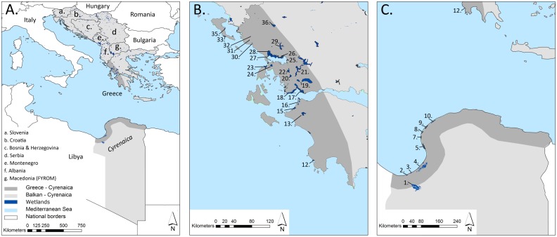
Fig 1. Delineation of the study area with indication of wetlands.
A Balkan-Cyrenaica: the number of patches for different wetland habitats at this extent can be consulted in Table 2; B and C Greece-Cyrenaica encompasses a 65 km coastal band in Greece (B) and Cyrenaica (Libya) (C). Focal wetlands are: (1) Sebkha Al Kabirah; (2) Sebkha Bishr; (3) Sebkha Hafiroun & Brega; (4) Sebkha Ajdabiya & Al Brayqah; (5, 6) Sekbha Karkurah; (7) Ghemines; (8) Sebkha Gandoufa; (9) Sebkha El Thama & Esselawi; (10, 11) Sebkha Al Kuz; (12) Pylos; (13) Techniti Limni Pineiou; (15,16) Strofilia, Kotychi & Araxos; (17, 18) Messolonghi; (19) Trichonis & Lysimacheia; (20) Ozeros; (21) Techniti Limni Kastrakiou-Stratiou; (22) Amvrakia; (23) Lefkada; (24) Voulkaria; (25,26,27,28) Amvrakikos; (29) Techniti Limni Pournariou; (30) Acheron; (31) Kalodiki; (32) Kalodiki North; (33) Korissia; (34) Kalamas; (35) Chalikiopoulou; (36) Ioannina. Neither Kosovo nor Cyrenaica were taken up as separate states in our text or maps, a practical issue which does not reflect a political judgement. See [34] and [33] for datasets of national borders.

