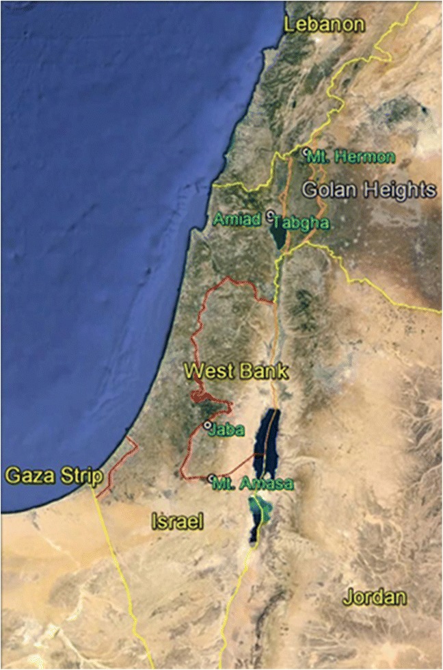
Fig. 1.

A map of Israel and the surrounding areas of the West Bank, Gaza strip and parts of Jordan, Lebanon and Syria. The five collection sites (Mount Hermon, Amiad, Tabgha, Jaba and Mount Amasa) of wild emmer wheat are indicated in green. This map was created in Google Earth. See Additional file 1: Table S1 for more details on the ecogeographical nature of the collection sites
