
Fig. 4.
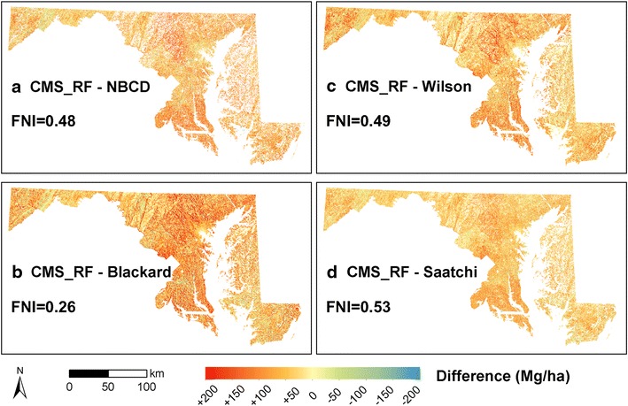
Difference maps of biomass density. a CMS_RF-NBCD_NCE at 30 m spatial resolution; b CMS_RF-Blackard at 250 m spatial resolution; c CMS_RF-Wilson at 250 m spatial resolution; and d CMS_RF-Saatchi at 100 m spatial resolution. Areas in red have lower values and areas in blue have higher values than the CMS_RF map. Fuzzy Numerical Index (FNI) quantifies overall similarity between the national biomass maps and the CMS_RF map, ranging from 0 (fully distinct) to 1 (fully identical).