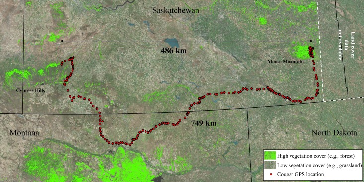
Figure 4. Long-distance dispersal of a sub-adult male cougar.
Dispersal route of a sub-adult male cougar (M7) that was fitted with a GPS-satellite collar in the Cypress Hills (Aug 2011) in southwest Saskatchewan, Canada. Cougar M7 travelled a cumulative distance exceeding 749 km over 100 days (13 Feb 2012–22 May 2012) before localizing in the vicinity of Moose Mountain Provincial Park in southeast Saskatchewan. Pixels highlighted in green represent mid to high vegetation cover (e.g., forest and shrub). The remainder of the pixels (no highlights) overlaying the satellite image are classified as open cover (e.g., agriculture, grasslands and pasturelands).

