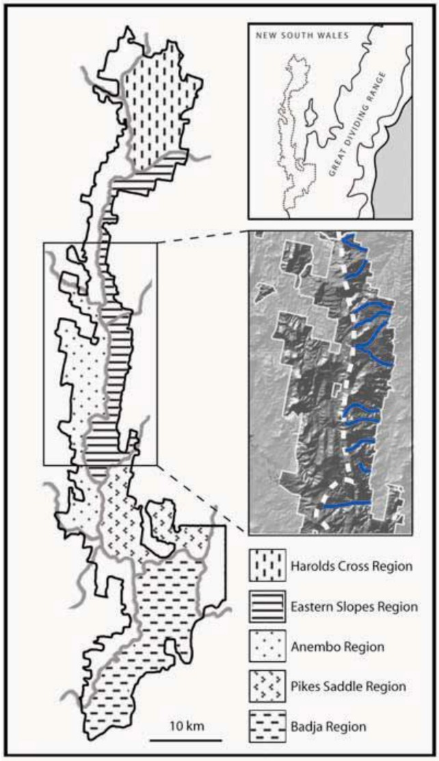
Figure 1.
Five a priori microgeographic regions of Tallaganda described by Garrick et al. [60]. Major and minor catchment divisions are represented by thick gray lines, with the study area circumscribed by black lines. Regional affiliations of areas in white were not delineated in the original landscape model. Upper inset: physiogeographic context of Tallaganda. Lower inset: Relief map of part of the Eastern Slopes Region. Given its easterly aspect, this region is (and no doubt was historically) exposed to high levels of orographic rainfall, in contrast to west-facing slopes. Thus the numerous east-west oriented gullies and creeks (blue lines) potentially served as moist, low-lying Pleistocene refuges for saproxylic invertebrates. The main ridgeline is marked by the dashed white line.

