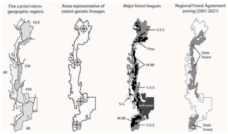
Figure 7.
Comparison of several alternative landscape classification schemes with the Australian Government’s [103] Region Forest Agreement zoning of Tallaganda. Far left. Five a priori microgeographic regions are based largely on topography, as well as broad understanding of palaeoclimatic changes in forest distributions and connectivity (see section 1.4; Figure 1). Left of centre: The areas marked with target symbols and identified as being ‘representative’ of evolutionarily distinct lineages were determined from the spatial distributions of genetic populations in five species (Figure 2). Locations are approximate, and alternative configurations may capture similar amounts of intraspecific diversity. Right of centre: The distribution of major forest leagues simplified from State Forests of New South Wales [105]. Abbreviations are: Scribbly Gum-Stringybark-Silvertop Ash, S-S-S; Messmate-Brown Barrel, M-BB; Snowgum, SG; commercial pine plantation, Pine. Far right: Areas of Tallaganda zoned as State Forest under the current Regional Forest Agreement’s ‘comprehensive, adequate and representative’ reserve system.

