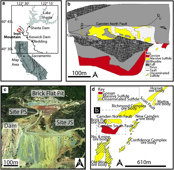
FIG. 1.
Local map, geological map, and sample sites from the Iron Mountain Brick Flat pit gossan. (a) Map showing the location of Iron Mountain in California (modified from Alpers et al., 2003). (b) Geological map of the Brick Flat massive sulfide deposit (modified from Albers, 1985). (c) Oblique view of sample sites PS and JS relative to the Brick Flat pit. Base image from GoogleEarth. (d) Map showing the location of the Brick Flat massive sulfide deposit relative to the other Iron Mountain cluster sulfide bodies (modified from Albers, 1985). The outlines of ore bodies are at different depths and are projected. Dashed box indicates the location of (b). The Okosh and Busy Bee ore bodies are not shown. (Color graphics available at www.liebertonline.com/ast)

