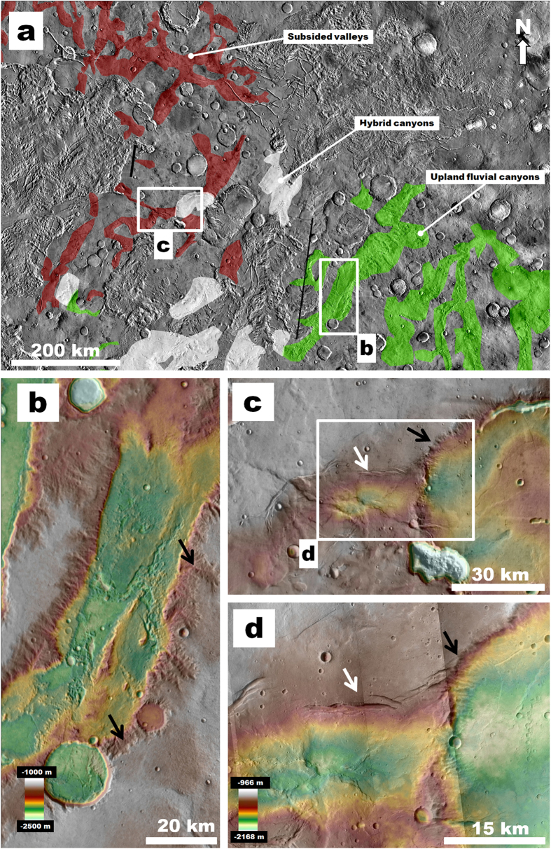
Figure 2.
(a) Map showing the distribution of hybrid canyons in terrains located along the boundary between upland fluvial canyons and subsided valleys (context and location in Fig. 1b). (b) Topographic view of an upland fluvial canyon, which shows margins densely marked by small valleys/channels (black arrows). (c,d) Topographic views of a subsided valley (white arrow) that extends eastward to join a hybrid canyon that exhibits a margin dissected by small valleys/channels adjoined by subsidence related fractures (black arrow). We produced the map in this figure using Esri’s ArcGIS geographic information system.

