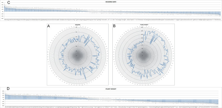
Figure 1.
Radar chart of the average heading date (A) and plant height (B) of the lines under study across two locations (SAL and LO) and two growing seasons (2011-12 and 2012-13). The data behind the graphs are reported in Suppl. material 2; only one every four lines is labelled in the graphs. The lines are sorted by year of release. Fold change variation of heading date (C) and plant height (D) is expressed as ratio between the average value of the single line and that of the population. Standard errors (SE) are represented by bars.

