
Fig 2. Removal of lens distortion.
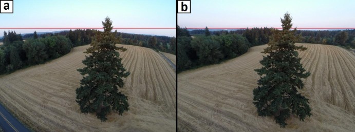
Demonstration of a. original, vs. b. OpenCV-calibrated lateral tree image obtained with a UAV-based GoPro camera at an above-ground altitude of 18 meters. Horizontal red line drawn to illustrate form of horizon in each version of the image.